- Age: 14-16 MYP Individuals and Societies
- Age: 14-16 GCSE / IGCSE Geography
- Natural Environments
- Economic Development
- IGCSE Geography Revision Question Bank
- 2.1 Earthquakes and volcanoes
- 2.4 Weather
- 2.5 Climate and natural vegetation
- Distribution
- Plate Tectonics
- Plate Boundaries | Plate Margins

Volcano case study - Mount Etna (2002-2003), Italy
- Volcano case study - Mount Nyiragongo, Democratic Republic of Congo
- Volcanic hazard management - Mount Rainier, USA
- Earthquakes
- Earthquake case study - 2005 Kashmir
- Earthquake case study - Chuetsu Offshore Earthquake - 2007
- Why was the Haitian Earthquake so deadly?
- Earthquakes - Managing the hazard
Can you describe the location of Mount Etna? Could you draw a sketch map to locate Mount Etna?

Case study task
Use the resources and links that can be found on this page to produce a detailed case study of the 2002-2003 eruption of Mount Etna. You should use the 'Five W's" subheadings to give your case study structure.
What happened?
The Guardian - Sicilian city blanketed in ash [28 October 2002]
When did it happen?
Immediately before midnight on 26 October 2002 (local time=GMT+1), a new flank eruption began on Mount Etna. The eruption ended after three months and two days, on 28 January 2003.
Where did it happen?
The eruption occurred from fissures on two sides of the volcano: at about 2750 m on the southern flank and at elevations between 2500 and 1850 m on the northeastern flank.

Why did it happen?
Mount Etna is a volcano. The reasons why Mount Etna is located where it is are complex. Here are some of the theories:
- One theory envisages a hot spot or mantle-plume origin for this volcano, like those that produce the volcanoes in Hawaii.
- Another theory involves the subduction of the African plate under the Eurasian plate.
- Another group of scientists believes that rifting along the eastern coast of Sicily allows the uprise of magma.
Who was affected by it happening?
- The Italian Government declared a state of emergency in parts of Sicily, after a series of earthquakes accompanying the eruption of forced about 1,000 people flee their homes.
- A ship equipped with a medical clinic aboard was positioned off Catania - to the south of the volcano - to be ready in case of emergency.
- Emergency workers dug channels in the earth in an attempt to divert the northern flow away from the town of Linguaglossa.
- Schools in the town have been shut down, although the church has remained open for people to pray.
- Villagers also continued their tradition of parading their patron saint through the streets to the railway station, to try to ward off the lava flow.
- Civil protection officials in Catania, Sicily's second-biggest city, which sits in the shadow of Etna, surveyed the mountain by helicopter and were ready to send water-carrying planes into the skies to fight the fires.
- The tourist complex and skiing areas of Piano Provenzana were nearly completely devastated by the lava flows that issued from the NE Rift vents on the first day of the eruption.
- Heavy tephra falls caused by the activity on the southern flank occurred mostly in areas to the south of the volcano and nearly paralyzed public life in Catania and nearby towns.
- For more than two weeks the International Airport of Catania, Fontanarossa, had to be closed due to ash on the runways.
- Strong seismicity and ground deformation accompanied the eruption; a particularly strong shock (magnitude 4.4) on 29 October destroyed and damaged numerous buildings on the lower southeastern flank, in the area of Santa Venerina.
- Lava flows from the southern flank vents seriously threatened the tourist facilities around the Rifugio Sapienza between 23 and 25 November, and a few days later destroyed a section of forest on the southwestern flank.
- The eruption brought a heightened awareness of volcanic and seismic hazards to the Sicilian public, especially because it occurred only one year and three months after the previous eruption that was strongly featured in the information media.
Look at this video clip from an eruption on Mount Etna in November 2007. What sort of eruption is it?
There is no commentary on the video - could you add your own explaining what is happening and why?
You should be able to use the knowledge and understanding you have gained about 2002-2003 eruption of Mount Etna to answer the following exam-style question:
In many parts of the world, the natural environment presents hazards to people. Choose an example of one of the following: a volcanic eruption, an earthquake, or a drought. For a named area, describe the causes of the example which you have chosen and its impacts on the people living there. [7 marks]
- Comment on Twitter
- Share full article
Advertisement
Supported by
When Kilauea Erupted, a New Volcanic Playbook Was Written
Scientists learned lessons from the 2018 outburst on the island of Hawaii that are changing how responders prepare for eruptions in other places.

By Robin George Andrews
Back in the summer of 2018, Wendy Stovall stood and stared into the heart of an inferno.
Hawaii’s Kilauea volcano had been continuously erupting in one form or another since 1983. But from May to August, the volcano produced its magnum opus , unleashing 320,000 Olympic-size swimming pools’ worth of molten rock from its eastern flank.
Dr. Stovall, the deputy scientist-in-charge at the U.S. Geological Survey’s Yellowstone Volcano Observatory , recalls moments of being awe-struck by the eruption’s incandescence: lava fountains roaring like jet engines, painting the inky blue sky in crimson hues. But these briefly exhilarating moments were overwhelmed by sadness. The people of Hawaii would suffer hundreds of millions of dollars in economic damage. The lava bulldozed around 700 homes. Thousands of lives were upended. Even the headquarters of the Hawaiian Volcano Observatory itself, sitting atop the volcano , was torn apart by earthquakes early in the crisis.
Like many volcanologists who were there during the eruption, Dr. Stovall is still processing the trauma she witnessed. Sadness is not quite the right word to describe what she feels, she said: “Maybe it’s an emotion that I don’t even have a word for.”
But not only trauma has resulted from the crisis: It has also produced something of a sea change in the way scientists and their emergency services partners are able to respond to volcanic emergencies.
During Kilauea’s devastating outburst, responders found novel ways to deploy drones and used social media to help those in the lava’s path. They also achieved more ineffable insights into how to keep cool in the face of hot lava. And this pandemonium of pedagogical experiences will prove valuable in times to come. The United States is home to 161 active or potentially active volcanoes — approximately 10 percent of the world’s total. When — not if — a Kilauean-esque outburst or something more explosive takes place near an American city, scientists and emergency responders will be better prepared than ever to confront and counter that volcanic conflagration.
A Patchwork of Fire

In volcano preparedness, knowing where the next socially disruptive eruption may take place is half the battle.
Not all of America’s active volcanoes are equally hazardous. Many in Alaska are situated on extremely remote islands . The Yellowstone supervolcano may sound frightening, but this cauldron does not deserve to be a boogeyman. “The odds of a supereruption happening are infinitesimally small,” said Emilie Hooft , a geophysicist at the University of Oregon.
California is home to at least seven potentially active volcanoes. Although they are “mostly where the people aren’t, a lot of California’s infrastructure crosses these volcanic zones,” said Andy Calvert , the scientist-in-charge at the Geological Survey’s California Volcano Observatory. An eruption at any of them could destroy power lines, highways, waterways and natural gas pipelines.
The volcanoes of the Pacific Northwest are not dissimilar to bombs lingering in the background of populous American ports, towns and cities. Some, like Mount St. Helens , are infamous for giant explosions and superheated, superfast exhalations of noxious gas and volcanic debris.
Others, like Washington State’s Mount Rainier, are more insidious. The volcano is known for making concrete-like slurries called lahars , in which freshly erupted ash mixes with snow or rainwater and gushes downslope, consuming everything in its path. These lahars “are a huge and real hazard,” Dr. Hooft said. Populous settlements within or at the terminus of the volcano’s many valleys, including parts of the Seattle-Tacoma metropolis, are built on ancient lahar deposits — and as the geologist’s refrain goes, the past is the key to the present.
Another major concern is America’s poorly understood volcanic fields: sprawling collections of cones, craters and fissures nestled between countless towns stretching from California to Washington State. Except for Mount St. Helens, said Dr. Stovall, “it is statistically more likely that an eruption will occur from any one of these volcanic fields than from one of the charismatic stratocones of the Cascades.”
While constantly watching Kilauea , the eyes of the Hawaiian Volcano Observatory also remain fixed on Mauna Loa, Kilauea’s colossal neighbor.
It has not erupted since 1984 — a disquietingly long pause. But in recent years, Mauna Loa has been grumbling. Several of this titan’s lava flows have come agonizingly close to obliterating the city of Hilo in the past century, and although they have serendipitously stopped short , they may one day succeed.
When Ken Hon , the scientist-in-charge at the Hawaiian Volcano Observatory, was asked if a future Mauna Loa eruption concerned him, he replied with a question of his own.
“Are you wary of a tiger when it’s sleeping?” he said. “It’s a sleeping tiger in your yard, and there’s no cage, and you’re just kind of watching it.”
A Kilauean Education
Fortunately, the lessons learned from the 2018 eruption have strengthened the armor of America’s volcanic vanguard.
Kilauea took not just the Hawaiian Volcano Observatory but the entire U.S. Geological Survey to school. During the 2018 crisis, staff from the Alaska, California, Cascades and Yellowstone observatories headed to Hawaii to assist, like white blood cells from throughout the body rushing to the site of a pathogen’s incursion. Despite some parts of America not seeing an eruption for over a century, this across-the-spectrum response allowed scientists from the Geological Survey to “keep the tools sharp,” Dr. Calvert said.
Hawaii’s lava factories are now better understood. They may sometimes be the deliverers of destructive horrors, but “volcanic eruptions are this amazing opportunity for scientists to do basic research,” said Ken Rubin , a volcanologist at the University of Hawaii at Manoa. The eruption in 2018, revealed that “there’s a lot of ways this volcano can operate,” he said.
Some key observations made during the 2018 crisis are likely to apply to countless other volcanoes, including those enigmatic volcanic fields on the West Coast. For instance, Kilauea stopped erupting despite retaining most of its magma . A change in the rhythm of its seismic soundtrack also revealed changes in the magma’s gloopiness , a key factor in an eruption’s explosive capacity. Monitoring such changes may help forecast how future eruptions will evolve, and how long they will continue once they start.
Kilauea’s outburst also changed the way scientists communicate with the public.
“It was the first big eruption we’ve had in the social media age,” said Tina Neal , director of the Geological Survey’s Volcano Science Center. During the eruption, her colleagues provided a constant stream of updates on Facebook and Twitter, debunking misconceptions and rumors. This proved to be one of the most effective ways of providing lifesaving advice to those fleeing the eruption.
“I’ll admit that I was skeptical of spending too much time delivering information via social media,” said Ms. Neal, who was the Hawaiian Volcano Observatory’s scientist-in-charge during the 2018 eruption. She was concerned that in doing so she would mainly be catering to curious but unaffected parties further afield.
But she said she was happy to be proved wrong — and added that she thinks the Geological Survey’s volcanologists now have an effective social media operation that can spring into action whenever a volcano starts twitching.
Drones and Tweets

The 2018 crisis also kick-started a nationwide technological revolution. It had long seemed strange to Angie Diefenbach , a geologist at the Cascades Volcano Observatory, that management did not appear to see the value of using drones to study erupting volcanoes in the United States, particularly as academics both inside and outside the country had been doing just that for several years.
Kilauea’s dramatic eruption was a paradigm-shifting moment. Ms. Diefenbach, who was already equipped with a pilot’s license, was sent to the effervescing volcano with a handful of keen colleagues and a small fleet of flying robots.
The pilots had a steep learning curve. The drones frequently flitted over the incandescent fury emerging from fissure eight, one of the two dozen cracks in the volcano’s flank, to film the seemingly endless flow of lava and sniff the chasm’s noxious gases.
“That fissure eight plume was intense, and the river of lava was extremely hot,” Ms. Diefenbach said. Every now and then, an upswell of heat would knock the levitating robots skyward by a couple hundred feet, threatening a loss of control that might plunge them into molten rock. Fortunately, they all survived to fly another day.
Immediately, she said, the powers that be recognized that drones “really add a fundamental piece to the story” for volcano monitoring. Bird’s-eye views of lava flows allowed scientists to study the evolution of the eruption in real time. And communities in the path of the lava could be given advance warning; at one point, a man trapped in his home at night and surrounded by lava was led by a drone through the maze of molten rock to safety.
Ms. Diefenbach, who works with uncrewed aircraft systems like drones for the Volcano Science Center, is now training more drone pilots across all five volcano observatories. While awaiting the next socially disruptive eruption, some of her drones are being used to study volcanoes that could one day reawaken, including inaccessible snowcapped peaks in Alaska.
Meandering Paths Forward
This is not to say that the scientists of the U.S. Geological Survey have been “twiddling their thumbs waiting” for a ruinous eruption like Kilauea, Ms. Neal said.
The agency’s staff are working constantly with their academic partners to improve their understanding of America’s fiery mountains. They are also continually learning from the way other countries respond to their own volcanic crises . The scientists regularly team up with emergency managers to conduct drills, including the annual evacuation exercises near Mount Rainier.
But the path to volcanic enlightenment is not a straight line. Although all of America’s active volcanoes are monitored, some considered to be high risk are not adorned with sufficient sensors. This can be a result of budgetary constraints, the difficulty of instrumenting treacherous volcanoes and, in some cases, red tape preventing the placement of sensors in wilderness areas.
“There are some volcanoes where we’re more at the starting line,” said Seth Moran , a seismologist at the Cascades Volcano Observatory, citing Washington’s Glacier Peak and Mount Baker .
Climate change and California’s increasingly intense wildfires are also aggravating the situation. A newly installed ground deformation sensor on Mount Shasta, for example, was taken out by this summer’s furious Lava fire , Dr. Calvert said.
Despite these setbacks, the Geological Survey continues to strengthen its monitoring efforts, with its network of instruments on several particularly hazardous volcanoes being upgraded and expanded . It also participates in tabletop exercises to test everyone’s mettle. One that took place over several days last November pitted scientists against a hypothetical eruption of Oregon’s Mount Hood.
Like the Kilauean eruption, this virtual volcanic gauntlet served up an underappreciated reminder: The people responding to volcanic crises may have extraordinary skill sets, but they are not superhuman.
“The general feeling afterwards was just of overwhelming exhaustion,” said Diana Roman , a geophysicist at the Carnegie Institution for Science and one of those who ran the exercise. “And that was part of the point.”
When it comes to America’s readiness for the next eruption, preparing scientists psychologically for the reality of a prolonged volcanic crisis is a necessity.
In 2004, when Mount St. Helens began to cough and splutter in a concerning manner, Dr. Moran became wrapped up in a surfeit of tasks. “It was about week three when my wife brought our kids to say good night to me,” he said. “That was my indication that I was probably doing too much. I should at least be able to get home and say good night to my kids.”
These experiences have taught Dr. Moran and his colleagues an invaluable lesson: “You can’t have people getting burned out right off the bat,” he said. Giving individuals clear roles ahead of time, and making their teams small and manageable, will hopefully prevent this sort of exhaustion in the future.
Though it’s not only scientists who can get drained during lengthy volcanic eruptions. As the weariness over the pandemic is grimly demonstrating , “it’s hard to keep people’s attention on something for a long time,” said Brian Terbush , the program coordinator for earthquakes and volcanoes at Washington State’s Emergency Management Division. “They get really tired of it. I’m tired of it.”
And protecting the public is considerably more difficult if people are not paying attention.
Fires of the Future

The location, timing and effects of America’s next volcanic disaster remain unknown. Even after a significant eruption begins, forecasting its evolution will be difficult.
“Even on the world’s best instrumented volcano,” said Dr. Hon, referring to Kilauea, “we still don’t really understand it that well.”
And yet, despite having so many dangers and complications to contend with, no one died and thousands of lives were saved during the 2018 crisis.
Those who were involved in the Kilauea response hope that the public will remember the role geoscientists played during the next volcanic emergency and see them as trustworthy protectors.
Not everyone will. “We often get told that we’re lying, and we’re hiding things, because we’re the government,” said Dr. Stovall — an uncomfortable echo of the similarly unfounded charges of conspiracy that many have directed toward public health professionals during the pandemic.
But the volcanologists and their peers say they will remain unwavering in their mission to decipher the country’s beguiling but occasionally menacing volcanoes.
“We are doing our best,” Dr. Stovall said. “And we’re in it for the greater good.”
Volcano case studies
Volcano case studies You should make sure you are familiar with 2 case studies: Either: Nyiragongo, Democratic Republic of Congo – Poor Country or Montserrat, Caribbean – Poor Country AND Either: Mount St. Helens, USA – Rich Country or Iceland – Rich Country
Key terms: Primary effects: the immediate effects of the eruption, caused directly by it Secondary effects: the after-effects that occur as an indirect effect of the eruption on a longer timescale Immediate responses: how people react as the disaster happens and in the immediate aftermath Long-term responses: later reactions that occur in the weeks, months and years after the event Nyiragongo Picture The video below contains more information on the primary and secondary effects of a volcano
On 17th January 2002 Nyiragongo volcano in the Democratic Republic of Congo (DRC) was disturbed by the movement of plates along the East African Rift Valley. This led to lava spilling southwards in three streams.
The primary effects – The speed of the lava reached 60kph which is especially fast. The lava flowed across the runway at Goma airport and through the town splitting it in half. The lava destroyed many homes as well as roads and water pipes, set off explosions in fuel stores and powerplants and killed 45 people
The secondary effects – Half a million people fled from Goma into neighbouring Rwanda to escape the lava. They spent the nights sleeping on the streets of Gisenyi. Here, there was no shelter, electricity or clean water as the area could not cope with the influx. Diseases such as cholera were a real risk. People were frightened of going back. However, looting was a problem in Goma and many residents returned within a week in hope of receiving aid.
Responses – In the aftermath of the eruption, water had to be supplied in tankers. Aid agencies, including Christian Aid and Oxfam, were involved in the distribution of food, medicine and blankets.
Montserrat – Poor country case study
Montserrat – Ledc Case Study from donotreply16 Mount St Helens – Rich country case study Picture Mount St. Helens is one of five volcanoes in the Cascade Range in Washington State, USA. The volcano erupted at 8:32am on 18th May 1980.
Effects – An earthquake caused the biggest landslide ever recorded and the sideways blast of pulverised rock, glacier ice and ash wiped out all living things up to 27km north of the volcano. Trees were uprooted and 57 people died.
Immediate responses – helicopters were mobilised to search and rescue those in the vicinity of the catastrophic blast. Rescuing survivors was a priority, followed by emergency treatment in nearby towns. Air conditioning systems were cleaned after by clogged with ash and blocked roads were cleared. Two million masks were ordered to protect peoples lungs.
Long-term responses – Buildings and bridges were rebuilt. Drains had to be cleared to prevent flooding. The forest which was damaged had to be replanted by the forest service. Roads were rebuilt to allow tourists to visit. Mount St. Helens is now a major tourist attraction with many visitor centres.
Iceland – Rich country case study Picture Location: Iceland lies on the Mid-Atlantic Ridge, a constructive plate margin separating the Eurasian plate from the North American plate. As the plates move apart magma rises to the surface to form several active volcanoes located in a belt running roughly SW-NE through the centre of Iceland. Eyjafjallajokull (1,666m high) is located beneath an ice cap in southern Iceland 125km south east of the capital Reykjavik
The Eruption: In March 2010, magma broke through the crust beneath Eyjafjallajokull glacier. This was the start of two months of dramatic and powerful eruptions that would have an impact on people across the globe. The eruptions in March were mostly lava eruptions. Whilst they were spectacular and fiery they represented very little threat to local communities, However, on 14th April a new phase began which was much more explosive. Over a period of several days in mid-April violent eruptions belched huge quantities of ash in the atmosphere.
Local impacts and responses: The heavier particles of ash (such as black gritty sand) fell to the ground close to the volcano, forcing hundreds of people to be evacuated (immediate response) from their farms and villages. As day turned to night, rescuers wore face masks to prevent them choking on the dense cloud of ash. These ash falls, which coated agricultural land with a thick layer of ash, were the main primary effects of the eruption. One of the most damaging secondary effects of the eruption was flooding. As the eruption occurred beneath a glacier, a huge amount of meltwater was produced. Vast torrents of water flowed out from under the ice. Sections of embankment that supported the main highway in Southern Iceland were deliberately breached by the authorities to allow floodwaters to pass through to the sea. This action successfully prevented expensive bridges being destroyed. After the eruption, bulldozers were quickly able to rebuild the embankments and within a few weeks the highway was reconstructed.
Local impacts: 800 people evacuated Homes and roads were damaged and services (electricity & water) disrupted Local flood defences had to be constructed Crops were damaged by heavy falls of ash Local water supplies were contaminated with fluoride from the ash
National impacts: Drop in tourist numbers – affected Iceland’s economy as well as local people’s jobs and incomes Road transport was disrupted as roads were washed away by floods Agricultural production was affected as crops were smothered by a thick layer of ash Reconstruction of roads and services was expensive
International impacts: Over 8 days – some 100,000 flights were cancelled 10 million air passengers affected Losses estimated to be £80 million Industrial production halted due to a lack of raw materials Fresh food could not be imported Sporting events such as the Japanese Motorcycle grand prix, Rugby leagues challenge cup and the Boston Marathon were affected
International impacts and responses: The eruption of Eyjafjallajokull became an international event in mid-April 2010 as the cloud of fine ash spread south-eastwards toward the rest of Europe. Concerned about the possible harmful effects of ash on aeroplane jet engines, large sections of European airspace closed down. Passenger and freight traffic throughout much of Europe ground to a halt. The knock-on effects were extensive and were felt across the world. Business people and tourists were stranded unable to travel in to or out of Western Europe. Industrial production was affected as raw materials could be flown in and products could not be exported by air. As far away as Kenya, farm workers lost their jobs or suffered pay cuts as fresh produce such as flowers and bean perished, unable to be flown to European supermarkets. The airline companies and airport operators lost huge amounts of money. Some people felt that the closures were an over-reaction and that aeroplanes could fly safely through low concentrations of ash. However, a scientific review conducted after the eruption concluded that under the circumstances it had been right to close the airspace. Further research will be carried out as a long-term response to find better ways of monitoring ash concentrations and improving forecast methods.

La Palma Eruption 2021
Date: Sept. 19, 2021 Type: Volcanoes Region : Africa , Canary Islands Info & Resources:
- View maps & data products for the La Palma eruption on the NASA Disasters Mapping Portal
- NASA Disasters program resources for volcanoes
- Latest updates from the Instituto Geologico y Minero de Espana (IGME)
- Latest updates from the Smithsonian Global Volcanism Program
- Latest updates from the Instituto Volcanológico de Canarias (INVOLCAN)
- Educational story map of La Palma data products & visualizations, developed by Esri
UPDATE Oct. 13, 2021
View fullscreen on the NASA Disasters Mapping Portal
Researchers working with the NASA ROSES A.37 project “ Day-Night Monitoring of Volcanic SO2 and Ash for Aviation Avoidance at Northern Polar Latitudes ” developed this animation of sulfur dioxide (SO2) clouds from the La Palma eruption using satellite data from NASA / NOAA Suomi-NPP and NOAA-20 Ozone Mapping and Profiler Suite (OMPS) spectrometers. Both satellites fly similar near-polar orbits, but are about 50 minutes apart. NOAA-20 OMPS measures with higher ground resolution. Using two satellites allows researchers to make more frequent, precise observations to identify hazardous densities of volcanic gases and aerosols.
The above animation shows SO2 column density in Dobson Units (1 DU = 2.69 x 10¹⁶ SO2 molecules /cm2) from Sept. 19 – 30, 2021. S02 is used to indicate the presence of volcanic gases and also as a proxy for volcanic aerosols (sulfuric acid or vog and ash), which can negatively affect air quality for people living in the region, as well as potentially damage aircraft flying through the volcanic clouds. Credits: NASA
Update Oct. 4, 2021

On Sept. 19, 2021, the Cumbre Vieja volcano on the island of La Palma in the Canary Islands started erupting after remaining dormant for 50 years. Since the initial eruption, the volcano has seen several Strombolian explosions , significant emissions of ash and gas, and multiple vents spewing molten lava down the mountain and into surrounding regions. According to the latest media reports over 800 buildings have been destroyed and about 6,000 people evacuated from the area.
The NASA Earth Applied Sciences Disasters program area has activated efforts to monitor the eruption and provide Earth-observing data and analysis in support of risk reduction and recovery for the eruption. The program is in contact with colleagues from the Instituto Geologico y Minero de Espana ( IGME ) and the Institut de Physique du Globe de Paris ( IPGP ) to share knowledge and data for situational awareness.
These efforts are being supported by the NASA ROSES A.37 research projects “ Day-Night Monitoring of Volcanic SO2 and Ash for Aviation Avoidance at Northern Polar Latitudes ” and “ Global Rapid Damage Mapping System with Spaceborne SAR Data .”

Related Impact

Connect with the Disasters Program
With help from NASA’s Earth-observing satellites, our community is making a difference on our home planet. Find out how by staying up-to-date on their latest projects and discoveries.
Stay Connected
Thank you for visiting nature.com. You are using a browser version with limited support for CSS. To obtain the best experience, we recommend you use a more up to date browser (or turn off compatibility mode in Internet Explorer). In the meantime, to ensure continued support, we are displaying the site without styles and JavaScript.
- View all journals
- Explore content
- About the journal
- Publish with us
- Sign up for alerts
- News & Views
- Published: 25 March 2024
- Volcanology
Underestimated volcanic hazard of Santorini
- Ben Kennedy ORCID: orcid.org/0000-0001-7235-6493 1
Nature Geoscience ( 2024 ) Cite this article
206 Accesses
2 Altmetric
Metrics details
- Physical oceanography
Volcanism after large, caldera-forming eruptions is thought to be muted. Exploration of the partially submerged caldera of Santorini reveals that large explosive eruptions have occurred since the caldera formed.
This is a preview of subscription content, access via your institution
Access options
Access Nature and 54 other Nature Portfolio journals
Get Nature+, our best-value online-access subscription
24,99 € / 30 days
cancel any time
Subscribe to this journal
Receive 12 print issues and online access
251,40 € per year
only 20,95 € per issue
Rent or buy this article
Prices vary by article type
Prices may be subject to local taxes which are calculated during checkout
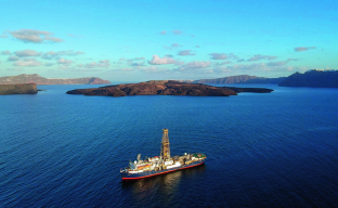
Thomas Ronge, IODP JRSO
Scott, E., Bebbington, M., Wilson, T., Kennedy, B. & Leonard, G. Development of a Bayesian event tree for short-term eruption onset forecasting at Taupō volcano. J. Volcanol. Geotherm. Res. 432 , 107687 (2022).
Article CAS Google Scholar
Preine, J. et al. Nat. Geosci. https://doi.org/10.1038/s41561-024-01392-7 (2024).
Article Google Scholar
Druitt, T. H. et al. Santorini volcano. J. Geol. Soc. London 19 , 176 (1999).
Google Scholar
Druitt, T. H., Kutterolf, S., Ronge, T. A. & Expedition 398 Scientists. Expedition 398 Preliminary Report: Hellenic Arc Volcanic Field (IODP Publications, 2024).
Druitt, T. et al. Giant offshore pumice deposit records a shallow submarine explosive eruption of ancestral Santorini. Commun. Earth Environ. 5 , 24 (2024).
Article ADS Google Scholar
Seabrook, S. et al. Volcaniclastic density currents explain widespread and diverse seafloor impacts of the 2022 Hunga Volcano eruption. Nat. Commun. 14 , 7881 (2023).
Article ADS CAS PubMed PubMed Central Google Scholar
Kennedy, B. M. et al. Magma plumbing beneath collapse caldera volcanic systems. Earth Sci. Rev. 177 , 404–424 (2018).
Article ADS CAS Google Scholar
Illsley‐Kemp, F. et al. Volcanic unrest at Taupō volcano in 2019: Causes, mechanisms and implications. Geochem. Geophys. Geosyst. 22 , e2021GC009803 (2021).
Download references
Author information
Authors and affiliations.
School of Earth and Environment, University of Canterbury, Christchurch, New Zealand
Ben Kennedy
You can also search for this author in PubMed Google Scholar
Corresponding author
Correspondence to Ben Kennedy .
Ethics declarations
Competing interests.
The author declares no competing interests.
Rights and permissions
Reprints and permissions
About this article
Cite this article.
Kennedy, B. Underestimated volcanic hazard of Santorini. Nat. Geosci. (2024). https://doi.org/10.1038/s41561-024-01395-4
Download citation
Published : 25 March 2024
DOI : https://doi.org/10.1038/s41561-024-01395-4
Share this article
Anyone you share the following link with will be able to read this content:
Sorry, a shareable link is not currently available for this article.
Provided by the Springer Nature SharedIt content-sharing initiative
Quick links
- Explore articles by subject
- Guide to authors
- Editorial policies
Sign up for the Nature Briefing newsletter — what matters in science, free to your inbox daily.

Case Studies Highlighting Impacts of Volcanic Ashfall, Gas & Vog
Case studies of past impacts and mitigation strategies for specific eruptions are given here. Sector specific information from these case studies also appear under their relevant topic headings (topics on the left).
Each case study begins with a brief overview discussing the size and volume of ash dispersed where known or approximated. Specific impact & mitigation information is organized into the following categories (where it is reported):
- Agriculture – Plants & Animals – includes livestock, pastoral land, horticulture and forestry.
- Health – direct and indirect from exposure.
- Infrastructure – may be summarised or some or all of the following are detailed depending on complexity
- Equipment & Communications
- Power supply
- Transportation
- Water & Wastewater
- Cleanup & Disposal
- Remobilization and coping with long-term ash – includes water and wind remobilised ash.
- Eyewitness &ndash Accounts from eruptions where available.
- Emergency management – monitoring, response during the eruption and recovery post eruption.
Please contact the Ash Web Team if you would like to contribute additional case study information. We are always looking for additional information.
Volcano World
- Central Andes (Under Construction)
- Hawaiian Volcanism
- Mount Saint Helens
- Volcanoes of Japan
- Extraterrestrial Volcanoes
- Teaching Resources
- Mount St Helens Living Lab
- Plate Tectonics
- Rocks and Minerals
- Prehistoric Earth
- Types of Volcanoes
- Eruption Styles
- Submarine Volcanoes
- Columnar Jointing
- Hydrovolcanism
- Volcanogenic Tsunamis
- Volcanic Minerals
- Volcanic Gases
- Volcanic Lightning
- Volcanic Sounds
- Volcanic Hazards
- GVP Current Eruption Reports
- US Volcano Activity Map
- Volcano Factoids
- Building Volcano Models
- Interviews with Volcanologists
- Working on Volcanoes
- Art Gallery
- Volcano Games
- Mount St. Helens by Helicopter
- Virtual Altiplano
- Virtual Altiplano Bolivia
- Around Santorini
- Climbing Mt Asama
- Driving Kilauea Rim Drive
- Exploring the Canary Islands
- Hiking Mount Ijen
- To the Top of Beerenberg
- Volcano Folklore
- Volcanic Parks
- Volcano Gallery
You are here
Case studies.

Left: Mt. Pinatubo eruption plume, July 1991, from Clark Air Base control tower. Photo by J.N. Marso, U.S. Geological Survey.
The effects of several historic eruptions have been observed and the impacts of larger, prehistoric eruptions can be estimated.

Estimates of the fraction of sunlight transmitted through stratigraphic aerosols after major eruptions. Roza refers to a flood basalt eruption in the northwestern United States. Graph from Rampino and others (1988).
The pages in this section explore the following case studies for their impact on global climate
Impact of some major historic eruptions.
Data from Rampino and Self, 1984.
- Mt. Pinatubo, Philippines - 1991
- El Chichon, Mexico - 1982
- Krakatau - 1883
- Tambora, Indonesia, 1815
- Laki, Iceland - 1783
- Toba, Indonesia, 75,000 years ago
Contact Info
VW is a higher education, k-12, and public outreach project of the Oregon Space Grant Consortium administered through the Department of Geosciences at Oregon State University.
Disclaimers and Policies | Login
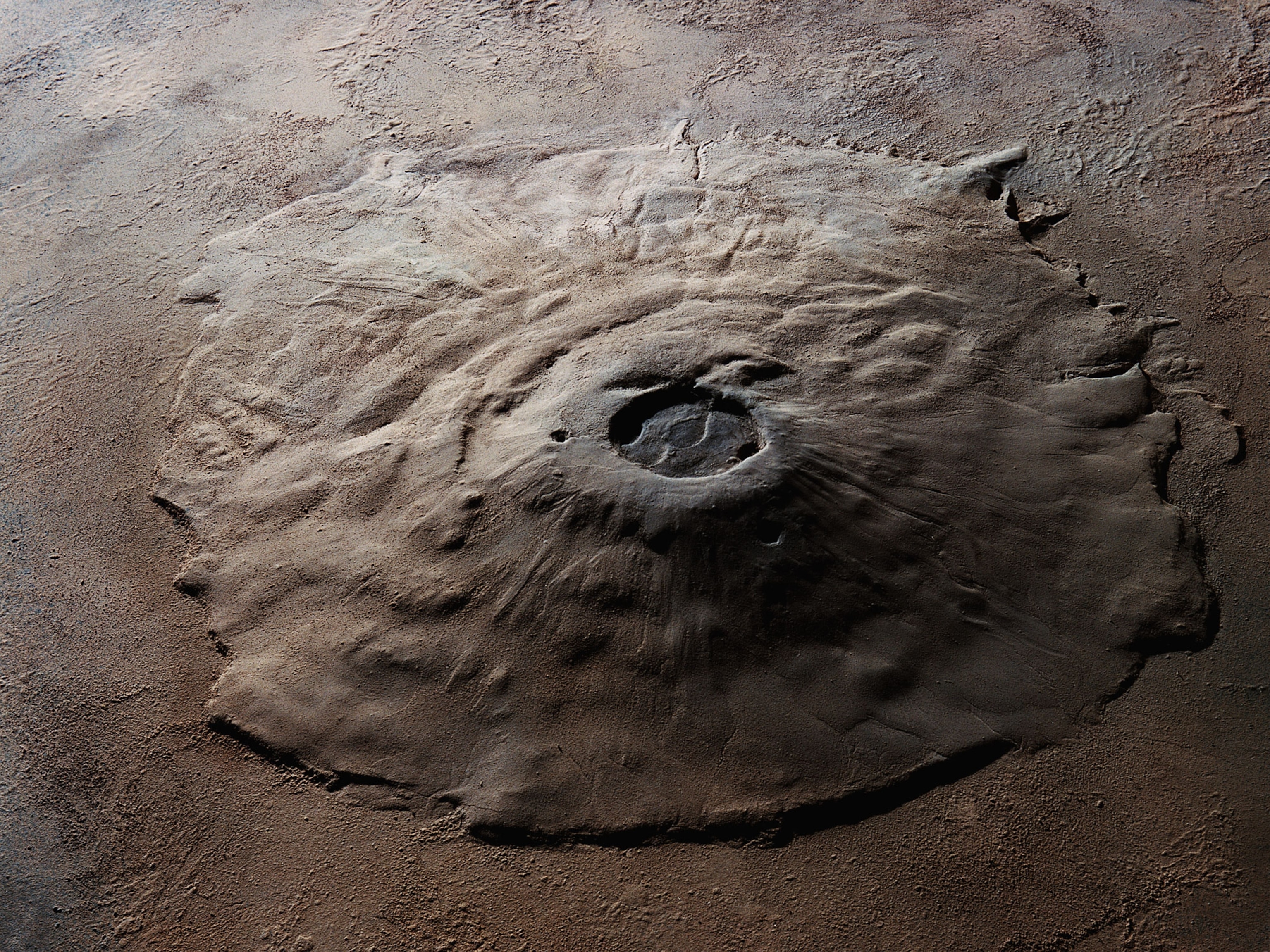
A 280-mile-long volcano may have been discovered on Mars—hiding in plain sight
The colossal volcano is taller than Mount Everest, would reach from New York City to Washington, D.C., and may be a promising site to look for ancient remnants of microbial life.

It’s not every day you discover a brand-new gigantic volcano on another planet—but that’s exactly what a pair of researchers claim to have done. At almost 30,000 feet tall (a little higher that Everest), and perhaps 280 miles long at its base (lengthier than the distance between Washington D.C. and New York City), it is an utter behemoth. Like all volcanoes on Mars, there are no signs that’s it’s currently active. And it could be remarkably ancient—a volcanic witness to most of the Red Planet’s multi-billion-year history.
“We were both in disbelief that this was indeed a giant volcano and that no one seemed to have reported it before,” says Pascal Lee , a planetary scientist at the SETI Institute, one of the two co-discoverers. “I think it's fair to say that we were excited.”
Lee and his colleague presented their findings at the Lunar and Planetary Science Conference in The Woodlands, Texas, last week. Found overlaying an expansive maze of water-eroded caverns and tunnels named Noctis Labyrinthus—meaning “Maze of the Night”—the team have given their putative volcano the provisional name of Noctis, pending further analyses by the scientific community. The volcanic architecture has been heavily eroded by eons of water and glacial movement, which they claim is why Noctis has been overlooked until now.
Mars’s magmatic past
Not everyone agrees that a colossal volcano has truly been discovered. The work has yet to be peer-reviewed, but those who saw the presentation at the conference are intrigued, but skeptical.
“The researchers made an interesting case, but it is not entirely convincing,” says Rosaly Lopes , a planetary scientist at NASA's Jet Propulsion Laboratory who wasn’t involved with the new work. “The area is highly eroded. It is difficult to tell for sure.” But, she adds, “I think most of us still think it is an interesting idea and worthy of more study.”
Mars was once a volcanically active world, featuring myriad explosive and effusive eruptions—and the construction of some truly elephantine volcanoes, including the famous Olympus Mons, which is three times taller than Everest. It’s so weighty, it even sank back into the planet a little.

Even though there are some tantalizing signs that future eruptions on the planet may occur, most scientists suspect Earth’s neighbor is past its eruptive heyday. And although small clusters of volcanic features are occasionally found by eagle-eye researchers, it’s presumed that the larger edifices have all be identified. Mars has an essentially transparent atmosphere, and aside from the odd global dust storm, its surface has been near-continuously perused by orbiting spacecraft, going back to NASA’s Mariner 9 satellite that arrived above the ochre world in 1971.
So when Lee, and fellow team member Sourabh Shubham , a Ph.D. student at the University of Maryland, claimed to have discovered a giant volcano, it came as a surprise.
Searching for an ancient volcano
Using a suite of orbital mission maps created over the past half-century, they focused on a field of deposits created by explosive volcanic activity, one that had been incised by the remains of a glacier. Wondering where this volcanic material may have erupted from, they looked nearby, to the eastern extent of Noctis Labyrinthus, and “we saw something remarkable,” says Lee: the shape of what they think is an eroded volcano, topped with a cauldron-like pit at its partly collapsed peak, and adorned with old lava flows, blankets of volcanic ash, and mineral patches cooked up by magmatically heated flowing water.
Based on the advanced extent of its erosion, the layering of its erupted matter, and comparing its fractures with those of Noctis Labyrinthus (whose formation time is broadly known), they suspect the volcano first took shape more than 3.7 billion years ago, then effervesced and erupted perhaps as recently as 10 million years ago.
“We are looking at a volcano whose activity spans the bulk of Mars' geologic history,” says Lee. And the presence of a prolonged heat source in an area known to have been adorned with glaciers also implies that this may be an exciting area for a future rover to explore—a former site of warm pools within which a robotic sleuth may find signs of past microbial life.
Despite Lee’s confidence, though, others aren’t convinced. The features identified as eruption deposits or volcanic landforms aren’t unequivocally volcanic, and it isn’t yet clear how continuous or not they are.
“This is not enough to convince me this is a volcano,” says Tracy Gregg , a planetary volcanologist at the University at Buffalo. “An impact crater that was filled and eroded could show similarities.”
While the possibility of a titanic overlooked volcano on Mars is tantalizing, more evidence is needed to confirm if this is truly an explosive new discovery.
FREE BONUS ISSUE
Related topics.
- SPACE EXPLORATION
- EXTRATERRESTRIAL LIFE
- SOLAR SYSTEM
You May Also Like
Today, it’s a massive volcano on Mars—but it may have once been an island

The 11 most astonishing scientific discoveries of 2023

In the hunt for alien life, this planet just became a top suspect

How far away is the sun? They went on a perilous journey to find out.
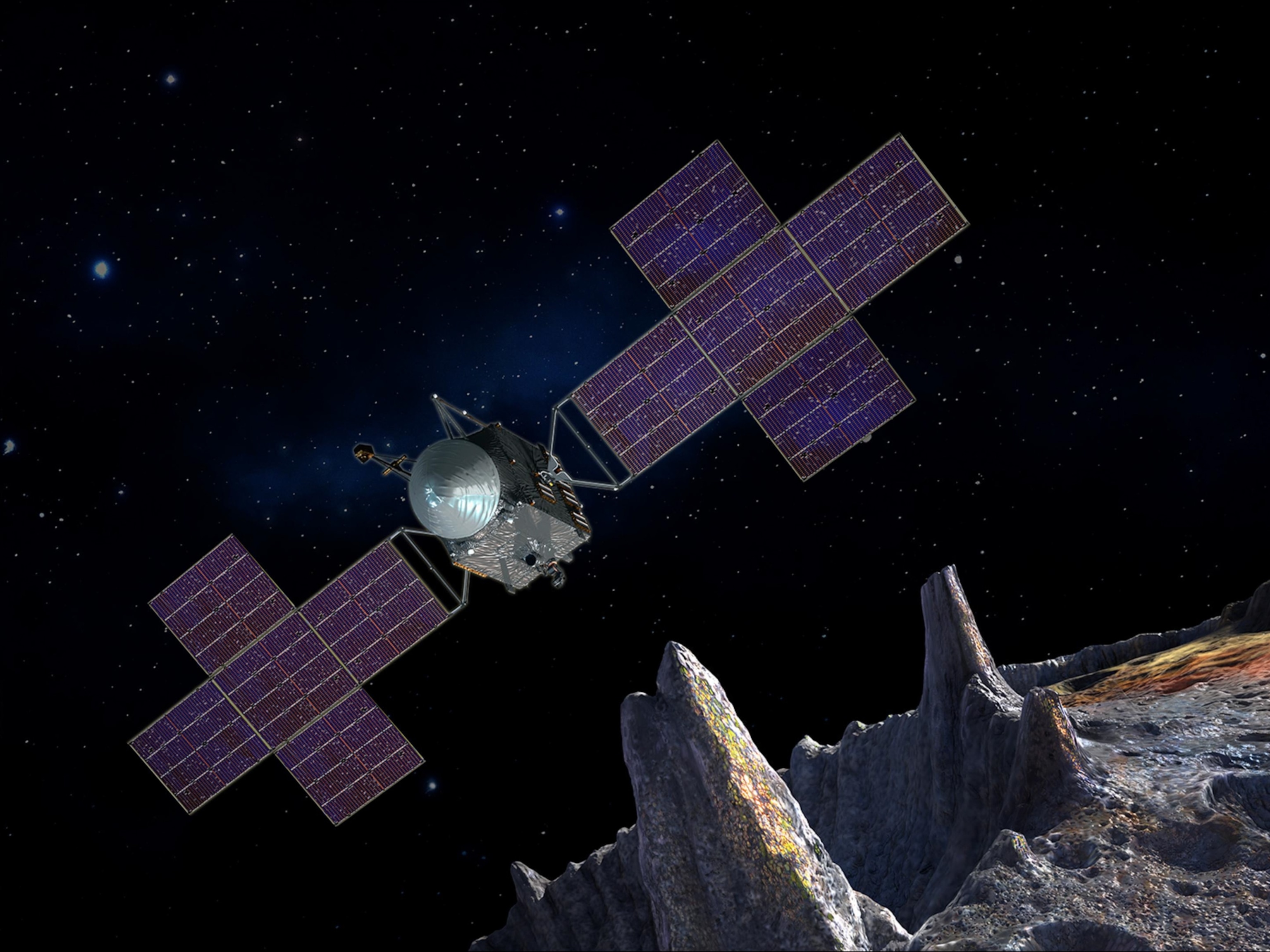
Humans are about to explore a metal-rich asteroid for the first time. Here's why.
- History & Culture
- Environment
- Paid Content
History & Culture
- History Magazine
- Mind, Body, Wonder
- Terms of Use
- Privacy Policy
- Your US State Privacy Rights
- Children's Online Privacy Policy
- Interest-Based Ads
- About Nielsen Measurement
- Do Not Sell or Share My Personal Information
- Nat Geo Home
- Attend a Live Event
- Book a Trip
- Inspire Your Kids
- Shop Nat Geo
- Visit the D.C. Museum
- Learn About Our Impact
- Support Our Mission
- Advertise With Us
- Customer Service
- Renew Subscription
- Manage Your Subscription
- Work at Nat Geo
- Sign Up for Our Newsletters
- Contribute to Protect the Planet
Copyright © 1996-2015 National Geographic Society Copyright © 2015-2024 National Geographic Partners, LLC. All rights reserved
- 0 Shopping Cart
Soufrière Hills Volcano, Montserrat, West Indies.
Soufrière Hills Volcano , Montserrat, West Indies. Synopsis of events by former Montserrat resident, photographer and Author Lally Brown.
Where is Montserrat? Montserrat is a small tropical island of approximately 40 sq. miles in the Caribbean, fifteen minutes flying time from Antigua. It is a British Overseas Territory and relies on UK Government aid money to survive. It is of volcanic origin with the Soufrière Hills above the capital of Plymouth the highest point of the island.
How and when did the volcano erupt? Prior to 1995 the volcano in the Soufrière Hills had been dormant for 350 years but on the morning of 18th July 1995 steam and fine ash could be seen coming from the flanks of the Soufrière Hills accompanied by a roaring sound, described as being like a jet engine. In the capital of Plymouth there was a strong smell of ‘bad eggs’ the hydrogen sulphide being emitted by the awakening volcano.
Montserrat was totally unprepared. No-one had ever imagined the dormant volcano would erupt. The Soufrière Hills was the breadbasket of the island where farmers worked the fertile agricultural land, while the busy capital and island port of Plymouth nestled at the foot of the hills.
Scientists arrived from the University of the West Indies to assess the situation. They said the volcano was producing ‘acoustic energy explosions’ at approximately half-hour intervals sending ash and vapour three to four hundred metres into the air.
What happened next? Before July 1995 Montserrat was a thriving tourist destination with a population of 10,000 people but over several weeks there was a mass exodus from the island and a run on the banks with people withdrawing cash.
Several areas near the vent that had opened up in the hillside were declared exclusion zones and residents were evacuated to the safe north of the island into schools and churches.
It was evident the volcano was becoming more active when a series of small earthquakes shook the island. Heavy rain from passing hurricanes brought mudflows down the hillsides into Plymouth. Sulphide dioxide emissions increased, a sure sign of heightened activity.
The scientists hoped to be able to give a six hour warning of any eruptive activity but when they discovered the magma was less than 1 km below the dome they said this could not be guaranteed, saying there was a 50% chance of an imminent eruption. An emergency order was signed by the Governor and new exclusion zones were drawn with people evacuated north.
The years 1995 to 1997 The Soufrière Hills volcano became increasingly active and more dangerous.
Montserrat Volcano Observatory (MVO) was established to monitor activity and advise the Government.
December 1995 saw the first pyroclastic flow from the volcano.
The capital of Plymouth was evacuated for the last time in April 1996.
Acid rain damaged plants.
Two-thirds of Montserrat became the new exclusion zone , including the fertile agricultural land.
Population dropped to 4,000 with residents leaving for UK or other Caribbean islands.
Frequent heavy ashfalls covered the island with blankets of thick ash.
On the seismic drums at the MVO swarms of small hybrid earthquakes frequently registered. Also volcano-tectonic earthquakes (indicating fracture or slippage of rock) and ‘Broadband’ tremors (indicating movement of magma).

- Click to share
- Print Friendly
MVO Seismograph printout Dec 1997
‘Spines’ grew rapidly out of the lava dome to heights of up to 15 metres before collapsing back.
Rainfall caused dangerous mudflows down the flanks of the Soufrière Hills.
Temporary accommodation was built to house evacuees living in churches and schools.
25th June 1997 Black Wednesday For a period of twenty minutes at 12.59 pm the volcano erupted without warning with devastating consequences. A massive pyroclastic flow swept across the landscape and boulders up to 4 metres in diameter were thrown out of the volcano. Over 4 sq.km was destroyed including nine villages and two churches. The top 300ft had been blown off the lava dome. Tragically nineteen people were caught in the pyroclastic flow and died.

Post Office and War Memorial 1997
Lateral blast December 1997 Midnight on Christmas Day 1997 the MVO reported that hybrid earthquakes had merged into a near-continuous signal clipping the sides of the seismic drum. At 3am on Boxing Day there was a massive collapse of the dome. Approximately 55 million cubic metres of dome material shot down the flanks of the volcano into the sea. Travelling at speeds of 250-300 km per hour it took less than a minute to slice a 7 km wide arc of devastation across southern Montserrat. The evacuated villages of Patrick’s and O’Garros were blasted out of existence. A delta 2 km wide spilled into the sea causing a small tsunami .

Police checkpoint Montserrat
March 1999 After a year of apparent inactivity at the volcano the Scientists declared the risk to populated areas had fallen to levels of other Caribbean islands with dormant volcanoes. Arrangements were made to encourage overseas residents to return. Plans were put in place to reopen the abandoned airport.
2000 to 2003 One year after the volcano had been declared dormant there was a massive collapse of the dome, blamed on heavy rainfall.
In July 2001 another massive collapse of the dome described as ‘a significant eruption’ caused airports on neighbouring Caribbean islands to close temporarily due to the heavy ashfall they experienced. A Maritime Exclusion Zone was introduced around Montserrat and access to Plymouth and the airport prohibited.
Soufrière Hills volcano was now described as a ‘persistently active volcano’ that could continue for 10, 20 or 30 years. (ie possibly to 2032).
In July 2003 ‘the worst eruption to date’ took place, starting at 8 pm 12th July and continuing without pause until 4 am morning of 13th July. Over 100 metres in height disappeared from the mountain overnight. It was the largest historical dome collapse since activity began in July 1995.
A period of relative quiet followed.
2006 The second largest dome collapse took place with an ash cloud reaching a record 55,000 metres into the air. Mudflows down the flanks of the Soufrière Hills was extensive and tsunamis were reported on the islands of Guadeloupe and Antigua.
Another period of relative quiet followed.

Soufriere Hills volcano 2007
2010 Another partial dome collapse with pyroclastic flows reaching 400 metres into the sea and burying the old abandoned airport. There was extensive ashfall on neighbouring islands.
Again followed by a period of relative quiet.
2018 Although the Soufrière Hills volcano is described as ‘active’ it is currently relatively quiet. It is closely monitored by a team at the Montserrat Volcano Observatory (MVO). They advise the Government and residents on the state of the volcano.
Negative effects of the volcano:
· Approximately two-thirds of Montserrat now inaccessible (exclusion zone);
· Capital of Plymouth including hospital, government buildings, businesses, schools etc. buried under ash;
· Fertile farming land in the south in exclusion zone and buried under ash;
· Population reduced from 10,000 to 4,000;
· Businesses left Montserrat;
· Tourism badly affected;
· Concern over long term health problems due to ash;
· Volcano Stress Syndrome diagnosed;
· Huge financial cost to British Tax Payer (£400 million in aid);
· Loss of houses, often not insured;
· Relocation to the north of Montserrat by residents from the south.
Positive effects:
· Tourists visiting Montserrat to see the volcano, MVO and Plymouth, now described as ‘Caribbean Pompeii’;
· Geothermal energy being investigated;
· Sand mining for export;
· Plans for a new town and port in north;
· New housing for displaced residents built;
· New airport built (but can only accommodate small planes);
· New Government Headquarters built;
· Businesses opening up in the north of the island;
· Ferry to Antigua operating.
Lally Brown
You can follow Lally Brown on Twitter.
If you are interested in reading a dramatic eyewitness account of life with this unpredictable and dangerous volcano then the book ‘THE VOLCANO , MONTSERRAT AND ME’ by Lally Brown is highly recommended. You can order a paper back or Kindle version on Amazon .
“As time moves on and memories fade, this unique, compelling book will serve as an important and accurate first-hand record of traumatic events, faithfully and sensitively recounted by Lally Brown.”
Prof. Willy Aspinall Cabot Professor in Natural Hazards and Risk Science, Bristol University.
Leave a Reply
Leave a reply cancel reply.
Your email address will not be published. Required fields are marked *
Save my name, email, and website in this browser for the next time I comment.
I agree to the terms and conditions laid out in the Privacy Policy
Notify me of follow-up comments by email.
Notify me of new posts by email.
This site uses Akismet to reduce spam. Learn how your comment data is processed .
Share this:
- Click to share on Twitter (Opens in new window)
- Click to share on Facebook (Opens in new window)
- Click to share on Pinterest (Opens in new window)
- Click to email a link to a friend (Opens in new window)
- Click to share on WhatsApp (Opens in new window)
- Click to print (Opens in new window)
Please Support Internet Geography
If you've found the resources on this site useful please consider making a secure donation via PayPal to support the development of the site. The site is self-funded and your support is really appreciated.
Search Internet Geography
Top posts and pages.
Latest Blog Entries
Pin It on Pinterest

An Everest-size volcano hiding in plain sight on Mars? New research make waves in the science community
Sign up for CNN’s Wonder Theory science newsletter. Explore the universe with news on fascinating discoveries, scientific advancements and more .
Scientists may have pinpointed a massive, oddly shaped volcano taller than Mount Everest on the surface of Mars — and it has been hiding in plain sight for decades, according to new research.
The possible identification of a previously unknown Martian volcano has made waves across the planetary sciences community since Mars Institute Chairman Dr. Pascal Lee, lead author of an abstract about the formation, presented the findings on March 13 at the 55th Lunar and Planetary Science Conference in The Woodlands, Texas.
The research has drummed up excitement — and attracted some skeptics.
Lee said he and Sourabh Shubham, a doctoral student of geology at the University of Maryland, College Park, have identified a volcano within Mars’ Noctis Labyrinthus region — a gnarled patch of terrain near the equator with a web of canyons. The volcano in the “Labyrinth of Night” may have eluded scientists despite years of satellite observation because it does not tower over its surrounding landscape, Lee said.
“It’s also deeply eroded, eaten up and collapsed by erosion to the point that unless you’re really looking for a volcano, you would be really hard-pressed to spot it very quickly,” he told CNN.
If the team is correct, the revelation could have broad implications for scientists’ understanding of Martian geology. And, Lee said, he hopes the discovery could help lure future exploratory missions to the area to search for water ice or even signs of life .
The smoking gun
Initially, the research team’s efforts led to a study presented in March 2023 that suggested the Noctis Labyrinthus region may be home to a massive glacier covered in salt deposits.
Since then, Lee and Shubham have pored through data collected by NASA’s Mars Reconnaissance Orbiter, trying to determine whether water might still be frozen beneath the salt.
The hunt for water ice is key — it’s a resource that could be used to sustain human exploration on Mars or even converted into rocket fuel. While scouring the landscape, however, Lee said he was struck by “this little lava flow next to the glacier.”
The lava hadn’t yet been fully oxidized, a process that would turn it the same muddy orange hue as the surrounding surface, Lee said.
That indicated the lava might be relatively fresh — the first hint that an undetected volcano might be lurking nearby.
“We started looking at the landscape carefully,” Lee said. “And sure enough, when we examined the high points of this region, we noticed that they formed an arc.”
That arc is reminiscent of a shield volcano, Lee added, a type of volcano that also exists on Earth. Shield volcanoes are characterized by their broad, gently sloping sides — appearing wider than they are tall.
That finding led Lee and Shubham to gather more evidence, eventually determining that a 29,600-foot (9,022-meter) peak was actually the tip of a Martian volcano.
That’s a few hundred feet taller than Mount Everest , which rises 29,029 feet (8,848 meters) above sea level.
Mapping Mars
Scientists have already cataloged and named more than a dozen volcanoes on Mars, including Olympus Mons , the tallest known volcano in our solar system.
Lee said he and Shubham are working to spell out the findings in a peer-reviewed paper, a more detailed work that could lend more credence to the idea across the scientific community.
But the hypothesis of the volcano’s existence is already attracting attention.
“It’s a big thing,” said Dr. Adrien Broquet, a Humboldt Research Fellow at the German Aerospace Center who has studied Martian volcanoes. “It’s as tall as the tallest mountain we have on the Earth. So, it’s not a small feature on Mars for which we’ve had a question mark. And we have plenty of question marks (about the surface of Mars.)”
A search for life in the Labyrinth of Night
The journey to identifying this volcano — which the team has provisionally named “Noctis volcano” — began in 2015, Lee said, when NASA asked the planetary science community to propose intriguing locations on Mars where the US space agency might land future human exploration missions.
Lee proposed a site just east of Noctis Labyrinthus, which was dubbed “Noctis landing.”
The location could be an ideal place to search for alien life on Mars, said Lee, who is also a planetary scientist at the SETI Institute, a nonprofit dedicated to searching for evidence of extraterrestrial life.
“Of course, we’re not looking for a little green man with antennae,” Lee said. “But we’re looking for microbes that would not fit into the tree of life on Earth.”
Noctis Labyrinthus could be ideally situated for this hunt, according to Lee.
“If you want to look for ancient life, you drive east (from Noctis Labyrinthus) into the canyons,” Lee said, referring to Valles Marineris , the largest canyon in our solar system.
There, explorers could “sift through the rock layers” to scour for fossils, he said.
Or, Lee suggested, a mission could venture west to a volcanic region called the Tharsis plateau, where warm caves may harbor living microbes.
With such tantalizing potential, Lee has committed to studying Noctis Labyrinthus to build a case for sending exploratory missions there.
A volcano, a glacier and the history of Mars
The existence of a volcano in Noctis Labyrinthus could also help explain the creation of this bizarre landscape.
Scientists suspect magma bubbling up from Mars’ interior formed the labyrinthian valleys, but the details are up for debate.
One theory is that when the magma pushed up on the Martian crust, it cracked and splintered, leaving behind a maze of branching canyons.
Lee favors an alternative theory: This model suggests that the Martian crust in Noctis Labyrinthus is full of ice. And when magma seeped in, it melted or vaporized ice and rock beneath the surface, causing swaths of the terrain to cave in.
The existence of a volcano in the region, Lee said, might offer more support for the latter theory.
The science of certainty
Three scientists who were not involved in the research told CNN that they would not be surprised if a volcano were hidden near Noctis Labyrinthus.
Volcanoes of all shapes and sizes riddle the surface of the broader region, including the Tharsis plateau to the west of Noctis Labyrinthus.
However, Dr. Ernst Hauber, a staff scientist at the German Aerospace Center’s Institute of Planetary Research, is one geologist in the community who would like to see a peer-reviewed paper before he accepts Lee and Shubham’s version of events.
“They are very vague about chronology, about the timing of events,” Hauber told CNN, referring to the brief abstract Lee and Shubham published.
Among Hauber’s questions: If the volcano could still be active, as Lee suggests, why hasn’t it poured lava into the surrounding canyons? Why aren’t there more visible signs of lava near the peak? Could this actually be an impact crater Lee is looking at?
“I’m a bit skeptical for several reasons,” Hauber said.
Broquet of the German Aerospace Center and Dr. David Horvath — a research scientist at the nonprofit Planetary Science Institute in Tucson, Arizona — both said in separate interviews they would like to see additional data supporting the ideas Lee and Shubham presented.
But Broquet and Horvath said they find the abstract intriguing.
“This does look like a really good candidate (for a volcano),” Horvath said.
Lee said he is welcoming input from other scientists, anxious for additional evidence to support his research. But he also expresses confidence.
“In this case, my sense is that there’s really no room for plausible alternate hypotheses,” Lee said, adding that he’s 85% to 90% certain he has located a new Martian volcano.
“But extraordinary claims require extraordinary evidence,” Lee added, quoting the late astronomer Carl Sagan, for whom he once worked as a teaching assistant.
For more CNN news and newsletters create an account at CNN.com
 tall, is the largest known volcano in the solar system - NASA SVS")
IMAGES
VIDEO
COMMENTS
The uninhabited island covers an area of approximately 325 ha (800 acres), which is only the peak of a much larger submarine volcano. White Island is privately owned. It was declared a private scenic reserve in 1953. Visitors cannot land without permission, however, it is accessible by authorised tourist operators by boat and helicopter.
Volcanic slopes are inaccessible, providing safe places for rare plants and animals away from human disturbance. Also, for the pass 4.5 million years, volcanic gases have been adding to the water and atmosphere, giving us a source of water in the present. Volcanoes also produce deposits of aluminum, diamonds, gold, nickel, lead, zinc, and ...
Mount Etna is a volcano. The reasons why Mount Etna is located where it is are complex. Here are some of the theories: One theory envisages a hot spot or mantle-plume origin for this volcano, like those that produce the volcanoes in Hawaii. Another theory involves the subduction of the African plate under the Eurasian plate.
Case study - volcanic eruption - La Palma, 2021 La Palma is one of the Canary Islands, which lie in the Atlantic Ocean. The Canary Islands are an autonomous region of Spain.
Hawaii's Kilauea volcano had been continuously erupting in one form or another since 1983. But from May to August, the volcano produced its magnum opus, unleashing 320,000 Olympic-size swimming ...
Volcano case studies. On 17th January 2002 Nyiragongo volcano in the Democratic Republic of Congo (DRC) was disturbed by the movement of plates along the East African Rift Valley. This led to lava spilling southwards in three streams. The primary effects - The speed of the lava reached 60kph which is especially fast.
The Hunga Tonga-Hunga Ha'apai (HTHH) volcano (20.536°S, 175.382°W) is an underwater caldera volcano located ~70 km north-northwest of Tonga's capital, Nukualofa. Recent Surtseyan-style eruptive activity was observed in 2009, from 2014 to 2015, and from 20 December 2021 to 15 January 2022 ( 17 ). In the lead-up to the 15 January 2022 ...
The St. Vincent case provides an important demonstration of how these principles were integrated, complementing synoptic analyses of the state-of-the-art in volcano observatory crisis operations 6 ...
The massive eruption of the Hunga Tonga-Hunga Ha'apai volcano this January in Tonga, in the south Pacific Ocean, was the volcanic equivalent of a 'near miss' asteroid whizzing by the Earth ...
What the Philippines volcano 'worst-case scenario' could look like. With millions of people at risk, experts are looking to past big eruptions to better understand the unique hazards this peak ...
The eruption of Eyjafjallajökull in 2010 is a crucial example of how a volcanic event can have local and global impacts. The incident underscored the importance of preparedness, monitoring, and international cooperation in minimizing the effects of such natural disasters. It also highlighted the interconnectedness of our modern world and how a ...
Case Study 4: Rabaul Volcano, New Britain Island, Papua New Guinea 688-m high Rabaul is a violent volcano on the tip of the Gazelle Peninsula in Papua New Guinea. Its most prominent feature is a caldera, with hills of pyroclastic material around it (Rabaul is described as a pryoclastic shield). The town of Rabaul is located within the caldera.
On Sept. 19, 2021, the Cumbre Vieja volcano on the island of La Palma in the Canary Islands started erupting after remaining dormant for 50 years. Since the initial eruption, the volcano has seen several Strombolian explosions, significant emissions of ash and gas, and multiple vents spewing molten lava down the mountain and into surrounding ...
The Cause and Effect of the 2018 Kilauea Volcanic Eruption. Volcanoes are present all over the world, and they are mostly unpredictable in terms of the time and effect of their explosions.
Eyjafjallajokull is located below a glacier. The Eyjafjallajökull volcano erupted in 920, 1612 and again from 1821 to 1823 when it caused a glacial lake outburst flood (or jökulhlaup). It erupted three times in 2010—on 20 March, April-May, and June. The March event forced a brief evacuation of around 500 local people.
The Santorini volcano is famous worldwide for its enormous eruption that has been linked to the demise of the Minoan civilization and produced the partially submerged caldera that we see today 2 ...
Volcanoes case study 1 -Eyjafjallajökull. Tectonic setting of the hazard. The nature of the hazard (type, magnitude, frequency) Vulnerability. Capacity to cope (prediction, prevention, preparation) Institutional capacity. The impact of the event (social, economic, environmental), in the short and longer term.
Each case study begins with a brief overview discussing the size and volume of ash dispersed where known or approximated. Specific impact & mitigation information is organized into the following categories (where it is reported): Agriculture - Plants & Animals - includes livestock, pastoral land, horticulture and forestry.
Case Studies. Left: Mt. Pinatubo eruption plume, July 1991, from Clark Air Base control tower. Photo by J.N. Marso, U.S. Geological Survey. The effects of several historic eruptions have been observed and the impacts of larger, prehistoric eruptions can be estimated. Estimates of the fraction of sunlight transmitted through stratigraphic ...
Preparedness Ambassadors Case Studies 1 VOLCANO: Mount St. Helens Volcanic Eruption CS5 Eruption in Washington causes the largest landslide in recorded history. Two Months of Warnings On March 16, 1980, Mount St. Helens awoke when a series of small earthquakes began. Hundreds more occurred over the next 11 days. On March 27, a steam explosion ...
CASE STUDY 1: Exploring an Underwa. ter Volcano (Kawio Barat) What is an Underwater Volcano? Submarine volcanic eruptions are characteristic of rift zones where crustal . plates are being formed. These rift zones are known as seafloor spreading . centers because they are places where tectonic plates. are moving away . from each other.
Nyiragongo Case Study. This case study has been developed to support students studying Edexcel B GCSE Geography. Tectonic Setting and Location. Mount Nyiragongo is a composite volcano located in the east of the Democratic Republic of the Congo (DRC). The volcano consists of a huge (2km wide) crater, usually filled with a lava lake, and is only 20km away from the city of Goma.
The volcano is situated on a constructive plate boundary between the North American and Eurasian plate . Eyjafjallajökull is a 500m long fissure volcano , that erupts basalt. Basaltic lava is fluid in nature. There is a glacier above the volcano. Hazards 10km high ash plume , containing sulphur , was emitted.
With an estimated rock equivalent volume of between 133 and 183 cubic-kilometers ( Mount St. Helens erupted a mere one cubic-kilometer of rock in 1980, and the collapse of Mount Mazama 7,700 years ...
The colossal volcano is taller than Mount Everest, would reach from New York City to Washington, D.C., and may be a promising site to look for ancient remnants of microbial life. This composite ...
Bandar Lampung City's coastal area is highly susceptible to coastal hazards due to its location within the subduction zone of the Indo-Australian and Eurasian tectonic plates. Additionally, the presence of the Anak Krakatau volcano in the Sunda Strait further increases the vulnerability of the city's coast to natural disasters. This study analyses the current social vulnerability in the ...
Soufrière Hills volcano was now described as a 'persistently active volcano' that could continue for 10, 20 or 30 years. (ie possibly to 2032). In July 2003 'the worst eruption to date' took place, starting at 8 pm 12th July and continuing without pause until 4 am morning of 13th July.
Scientists may have pinpointed a massive, oddly shaped volcano taller than Mount Everest on the surface of Mars — and it has been hiding in plain sight for decades, according to new research.